Applications are closing soon. There is still time to apply to start your study in Trimester 2. Apply by Monday 1 June.
Explore Surveying degrees
Undergraduate (your first degree)
An undergraduate degree is an academic program of study that leads to a qualification, such as an associate degree, diploma or bachelor's degree. It's typically the first degree you undertake when entering university or an additional degree you can take on if changing your career path.
- 2 years (or part-time equivalent)
- Springfield
- External
- Feb, Sep
- 4 years (or part-time equivalent)
- Toowoomba
- External
- Feb, Jun, Sep
- 4 years (or part-time equivalent)
- Springfield
- Toowoomba
- Online
- Feb, Jun, Sep
- 3 years (or part-time equivalent)
- Toowoomba
- External
- Online
- Feb, Jun, Sep
- 4 years (or part-time equivalent)
- Springfield
- External
- Feb, Sep
- 3 years (or part-time equivalent)
- Springfield
- External
- Feb, Sep
- 0.5 years (or part-time equivalent)
- Online
- Feb, Jun, Sep
Research (higher degrees by research)
Research degrees are master's or doctorate/doctoral programs centred on in-depth study within a specific field, allowing you to conduct highly specialised research under the guidance of expert supervisors.
- 4 years (or part-time equivalent)
- Ipswich
- Springfield
- Toowoomba
- Online
- Jan, Feb, Apr, May, Jun, Aug, Sep, Nov
- 2 years (or part-time equivalent)
- Ipswich
- Springfield
- Toowoomba
- Online
- Jan, May, Aug
Studying at UniSQ


Frequently asked questions
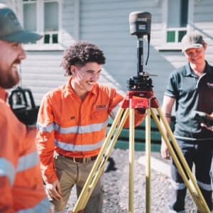
Surveyors are responsible for determining the relative positions of objects on the surface of the Earth. They use geometry to map the Earth's surface. Surveyors work in various fields, including for a consultancy, the government, land developers, mining companies or construction organisations.
They play an important role in our society. Without surveyors, we would be unable to build roads, bridges, and other structures. They help us understand the land so we can use it wisely.
An Associate Degree of Surveying is the perfect stepping stone into the Bachelor of Surveying Technology and the Bachelor of Surveying - Honours. The knowledge you gain from an associate degree will kickstart your career as a surveying technician or associate.
A Bachelor of Surveying Technology means you’re eligible for registration as a graduate surveyor and will qualify you to further your studies in the Bachelor of Surveying - Honours.
Yes, it's possible to begin a career in surveying without a university degree. Entry-level positions, such as surveying assistants or technicians, often require vocational qualifications like a Certificate in Surveying or a Diploma in Spatial Science. These roles provide practical experience and can serve as a stepping-stone into the surveying profession.
However, to become a registered or licensed surveyor in Australia, most states and territories require the completion of an accredited bachelor's degree in surveying such as a Bachelor of Surveying (Honours). This formal education ensures you have the necessary knowledge and skills to perform complex surveying tasks and to meet professional standards.
Surveying degrees are intellectually challenging, combining elements of mathematics, physics, geography, and technology. Students engage with subjects like geospatial science, land law, and data analysis, and gain proficiency in using advanced equipment and software.
At UniSQ, our surveying programs are designed to support students through this rigorous curriculum. We offer flexible study options, including online learning, and provide access to experienced academics and industry professionals and comprehensive resources to help you succeed in your studies.
Absolutely. Australia is currently experiencing a significant shortage of qualified surveyors, driven by ongoing infrastructure projects, urban development, and resource exploration. Reports indicate that the surveying profession will require an average of 1,500 additional professionals annually to meet national demands.
This high demand translates into excellent job prospects and competitive salaries for graduates. By pursuing a surveying degree at UniSQ, you'll be well-positioned to enter a profession that is not only in demand but also plays a crucial role in shaping Australia's future.
Take your first step

UniSQ is collecting the personal information on this form for support for students and prospective students and for marketing purposes. By submitting this form, you consent to the terms of UniSQ's marketing privacy statement. Further information concerning privacy is available.
Welcome aboard! We've got your details.
Something doesn't look right. Try that one again.